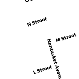
50 L STREET
Owner Information
MILLEN JEFFREY TRS
5 Q ST
HULL, MA 02045-0000


Property Details
50 L STREET is classified as a Mixed Use (Primarily Residential, some Commercial) (Old/mix).
The primary structure on this property was built in 1900. There are 3,872ft2 of built area within this property. There is 3,872ft2 of residential/living space within this property. This property is listed as having 7 rooms. There are 4 units within this property.
50 L STREET is valued at $528,300. The land is valued at $143,300 and the structures are valued at $385,000.
This property is in Zone BUS. Confirm with local Zoning Board authorities to ensure there are no overlays or other easements on this property.
The most recent deed for 50 L STREET is recorded at the local registrar in Book 48720, Page 251. 50 L STREET was last sold on Friday, July 28, 2017 for $100.
Assessment data from fiscal year 2022.
Flood Data
This property is completely within the AO Zone (shallow flooding, up to 2 feet).
This information is sourced from the FEMA National Flood Hazard Layer. See our full disclamer.
Broadband Internet Providers
| Provider | Type | Bandwidth (mbps) | |
|---|---|---|---|
| HughesNet | Satellite | 25 | 3 |
| VSAT Systems, LLC. | Satellite | 2 | 1 |
| Verizon New England Inc. | DSL | 3 | 0 |
| Viasat Inc | Satellite | 100 | 3 |
| Verizon New England Inc. | Fiber | 940 | 880 |
| Comcast | Cable | 1000 | 35 |
| GCI Communication Corp. | Satellite | 0 | 0 |
Broadband service provider data from December 2020.